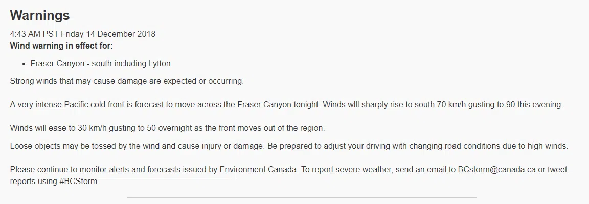
It’s been a messy week on the Coquihalla, but today might just be the worst day.
Environment Canada is urging people to put off all non-essential travel, as they’re calling for near zero visibility at times.
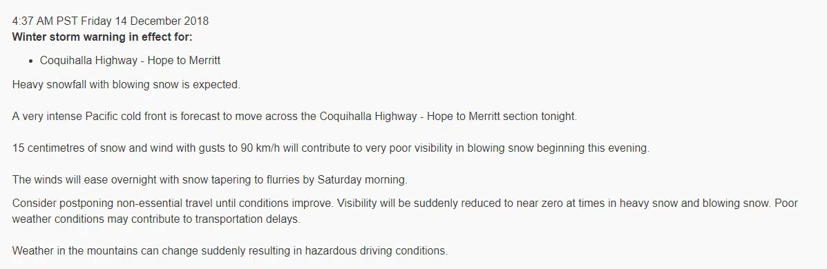
Meteorologist Matt MacDonald says they’re expecting a really strong cold front to blow on the Coquihalla this evening.
“And it’s going to be one of these scenarios where it’s going to from rain or wet snow and get colder as the evening goes on,” he said. “It gets really windy which is why we’re issuing a winter storm warning.”
“Snow is going to get lighter, get blown around with some really strong winds. Typically the windiest stretch of the highway is from Merritt to Kamloops.”
If you were planning on taking the Fraser Canyon instead, there will be similar strong winds there as well.
“When we see these things blow through, there’s a four to six hour period where things get particularly ugly,” McDonald added. “Wind warnings are posted right across the southern half of the province with this incoming cold front.”
“Often times, it’ll just remain confined to the coast but in this case, the system is tracking right across the Coastal Mountain Range and into the Interior.”
Conditions should improve tomorrow – but you could expect more winds and rain on the Coquihalla Sunday and into next week.