


Forecasters are urging backcountry enthusiasts to use extreme caution after a major winter wallop today – first day on winter.
Avalanche Canada Senior Forecaster Grant Helgeson says while some areas of the Southern Interior like Kamloops have until now been conspicuously absent of any snow – that’s not the case at higher elevations and above the treeline.
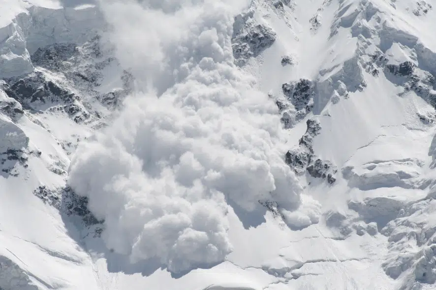
“We actually have a pretty mature snowpack; upwards of two-metres of snow and its setting up to be a pretty scary situation actually,” he said, on the NL Noon Report. “What the snowpack doesn’t like is those big periods of drought and then those big storms and that’s exactly what we have right now.”
Helgeson says in recent days there has been over a metre of snow accumulating in the alpine areas above the treeline, on top of a more icy layer.
“The crust – it’s thick. It’s anywhere from three to five centimetres thick and then its this rotten snow on top. People often refer to it as hoar frost, we call it surface hoar. They’re just kind of little champagne glasses that can hold a little bit of weight, and then we’ve got this big metre of new storm snow that’s sitting on top of that,” he said. “So you’ve got that bed surface that avalanches run on, you flick one of those champagne glasses of weak snow, and that whole metre of snow is moving.”
“To wrap your brain around how big that is, that’s enough to destroy your pickup truck if an avalanche like that hits you.”
Helgeson says the unstable snow conditions will likely persist for a couple more weeks across much of the southern half of the province, noting there have already been large, powerful slides in the backcountry.
And for people still tempted to venture out to areas above the treeline, Helgeson says to be prepared by carrying an emergency transceiver and an avalanche probe.


