


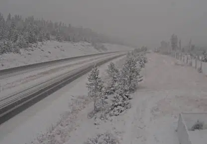
The Coquihalla Highway at Walloper on Oct. 28, 2020, looking north. (DriveBC webcam)
Heavy snow is falling at higher elevations outside of Kamloops this morning, as a snowfall warning is in place for several areas.
The warning from Environment Canada covers the Coquihalla from Hope to Merritt and the Okanagan Connector. A special weather statement is also in place for the Trans-Canada Highway from Eagle Pass to Rogers Pass.
The forecast says precipitation will last all day and into this evening, with snow changing to rain at many higher elevations. The forecast calls for 15-20 centimetres of snow at the Pennask Summit today, and 10-15 cm is expected to fall at the Coquihalla Summit, followed by 15-25 millimetres of rain starting this afternoon.
There’s no special weather advisory between Merritt and Kamloops on the Coquihalla, but snow has been falling this morning and up to 5 cm is expected at the Surrey Lake Summit before snow stops this afternoon.
Rogers Pass could also see 10 cm of snow today and a further 10 cm tonight.
Aside from highways, heavy snow has also been reported in higher-elevation communities like Logan Lake, Lac Le Jeune and Sun Peaks this morning.
There has been no sight of snow yet in the valley bottom in Kamloops this season; the forecast calls for 10-15 mm of rain today and showers overnight, with the snow level not expected to drop below 1,100 metres.


