


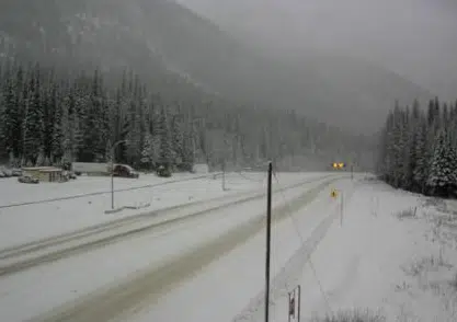
The Trans-Canada Highway at Rogers Pass on Nov. 12, 2021. (DriveBC webcam)
Environment Canada is warning about snowfall on area highways over this coming weekend.
A special weather statement has been issued for both sections of the Coquihalla, for the Okanagan Connector and for the Trans-Canada Highway at Rogers Pass.
The forecast says heavy snow will start tomorrow night, with the potential for 15-20 centimetres of snow to fall for the passes affected.
A special weather bulletin says an “atmospheric river” from the Pacific will bring heavy precipitation to the southern Interior, with rain at lower elevations and snow at higher-up areas.
While “upwards of 15-20 cm” of snow is expected, the bulletin says it’s still unclear exactly how much snow will fall in different parts of the southern Interior.
By Sunday morning, the snow is expected to change to heavy rain on all mountain passes, which the forecast says will last until Monday morning.
“Rapid warming in combination with heavy precipitation may lead to excessive melt off and localized flooding,” the bulletin also says, saying additional weather warnings will likely be issued sometime during the weekend.
In Kamloops, as of early Friday afternoon, the forecast is calling for mild weekend temperatures and rain on Saturday evening, which will taper off overnight.


