


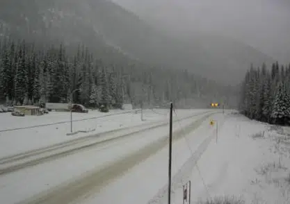
The Trans-Canada Highway at Rogers Pass on Nov. 12, 2021. (DriveBC webcam)
Wet weather is on the way for much of southern B.C. in the coming few days, which has prompted warnings in many areas.
Two atmospheric river weather events will come off of the Pacific Ocean between now and Sunday night, which has led to rainfall warnings for the Lower Mainland east all the way to Hope.
The rainfall is expected to be less significant than an historic storm two weekends ago, but there’s concern about runoff because of soil saturation and also about melting snow at higher elevations.
Geoff Coulson of Environment Canada says it appears the southern Interior will avoid the brunt of two separate rainstorms that will hit southern B.C., between now and Sunday.
“By the time we get into the Interior of B.C., there’s not really much moisture left over. And that’s really what we’re seeing in the event we’re going to be seeing through tonight and into Friday morning, is that a lot of that moisture will be raining out before it gets to the Interior. So in the forecast, not really much more than shower activity for Kamloops is expected. And really for the one on the weekend, not much in the way of precipitation is expected at all.”
Some forecasters are calling for 115 millimetres of rain in Hope by Sunday night, compared to just 13 mm for Merritt and even less amounts for Kamloops.
“And obviously given what’s happened with the first atmospheric river in the middle of the month, this is certainly not good news for the folks of Abbotsford, Hope and Chilliwack,” Coulson says.
“And the models are actually hinting at yet another atmospheric river for southern B.C. next Tuesday into Wednesday. So really one after the other, in a situation where we’ve already seen extensive damage and flooding occurring.”
During a news conference yesterday on the current flooding situation, Public Safety Minister Mike Farnworth warned that ” the next nine or 10 days could be quite challenging” because of rainfall in the forecast for southern B.C.
Currently, there’s no indication from officials that heavy rain for southern B.C. will cause further flooding in parts of the Interior, like what was seen in places like Merritt, Princeton, and the Nicola River watershed during the previous storm. NL News will provide clear information in a timely matter if that situation is forecast to change.
Meanwhile, in the interior, a winter storm warning is in place for Eagle Pass to Rogers Pass on the Trans-Canada Highway. The forecast says 30-40 centimetres of snow will fall between this evening and Friday afternoon.
Travellers are advised to check DriveBC for updates on highway conditions.


