


Chase RCMP say two people have gotten stuck while following these Google Maps directions to Sun Peaks Resort. (Photo via Google Maps)
RCMP in Chase are urging caution after two recent instances where people who followed Google Maps while heading to Sun Peaks had to be rescued.
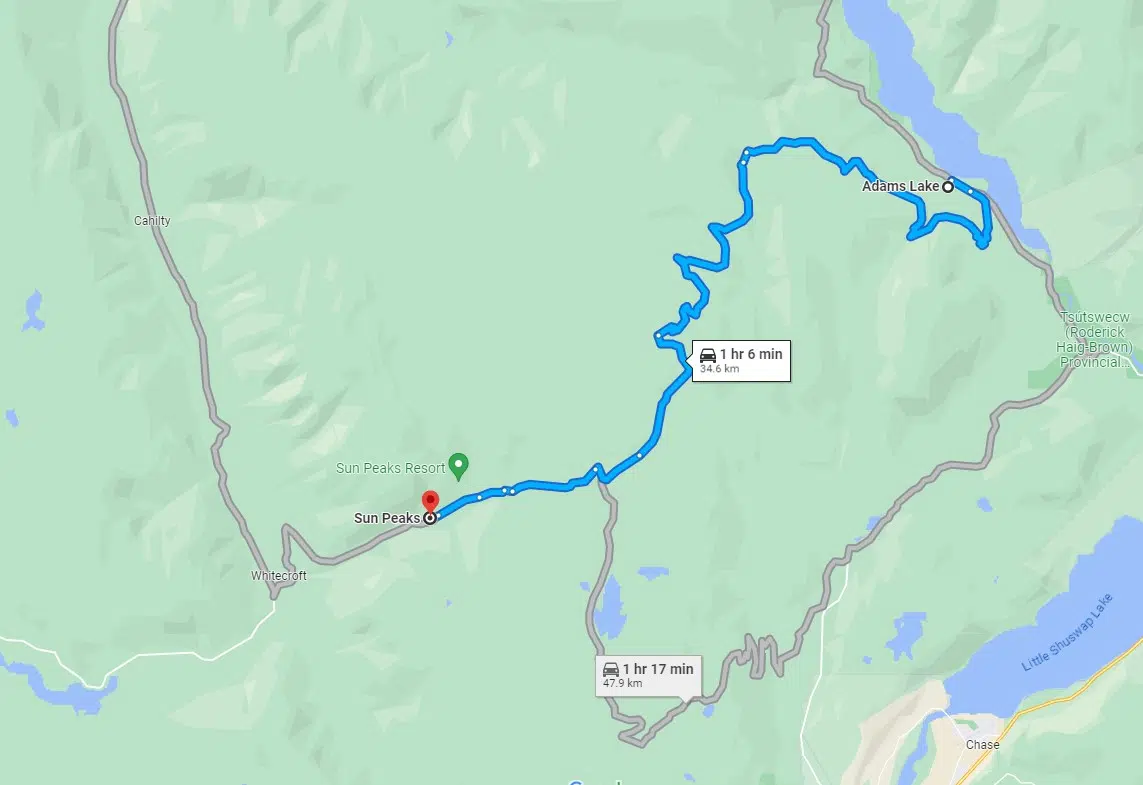
The first instance was on May 13. Police say a woman who was following Google Maps directions to Sun Peaks needed to be rescued after she got lost in the dark around 9:30 p.m. near the Cahilty Forest Service Road in Adams Lake.
“Unsurprisingly, her Honda Fit was not equipped for the terrain she encountered,” RCMP said, in a news release. “Luckily, she turned around before she became stuck in the snow. Police were eventually able to locate her and guide her back to civilization.”
The second instance happened six days later, on May 19. Police say they were called to help another driver who was stranded in the same area around 8:50 p.m.
“This caller reported he was travelling from Calgary to Sun Peaks. Google Maps directed him to travel by Forest Service Road from Adams Lake to Sun Peaks; he followed those directions precisely until his vehicle got stuck in the snow,” the release said.
Police say they were trying to find the family when they were told that they were able to free their vehicle, and decided to head back instead of carrying on to Sun Peaks.
Heffley-Louis Creek Road, accessible from Highway 5 north of Kamloops, is the main road into Sun Peaks.
There are a number of other access routes, including the McGilivray Lake Forestry Road to Chase, though many of those secondary routes are not paved and impassable to most vehicles when there is snow on the ground.


