


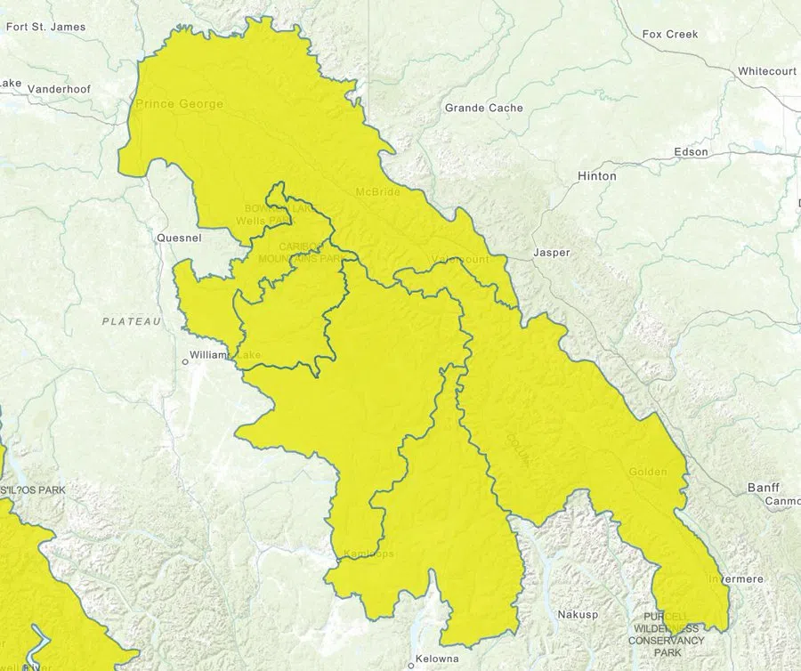
The B.C. River Forecast Centre has issued a High Streamflow Advisory for the Kamloops region and surrounding areas, as another storm system moves inland, bringing the risk of heavy rainfall this weekend.
The advisory, issued at noon on Friday, includes both the North and South Thompson regions—encompassing tributary rivers near Clearwater, Blue River, Adams River, and Seymour River. These watersheds feed into the Thompson River system, which runs directly through Kamloops.
While no major flooding is currently expected, officials warn that rapid increases in river levels are likely, particularly in smaller creeks and streams. Flows are anticipated to start rising Saturday evening, with peaks expected by Sunday.
According to the Ministry of Water, Land and Resource Stewardship, rainfall totals in affected areas could range from 20 to 50 millimetres, with higher amounts possible in localized areas. The added water from the upcoming storm could be intensified by already elevated flows from last weekend’s precipitation—especially in the Upper Fraser region.
Local residents are also being reminded that wildfire-affected zones could see enhanced runoff, increasing the risk of flash flooding or debris flow in burn scar areas.
A complicating factor in this advisory is the ongoing job action by members of the BC General Employees’ Union and the Professional Employees Association, which is affecting the River Forecast Centre’s ability to access its full suite of data. This means that forecasts currently carry a higher level of uncertainty than usual, and should be interpreted with caution.
Kamloops residents and those in nearby communities are advised to:
-
Stay clear of fast-flowing rivers and unstable riverbanks;
-
Keep children and pets away from waterways;
-
Monitor local weather and streamflow updates closely over the weekend.
The River Forecast Centre will continue to monitor the situation and issue updates as conditions evolve.
The #BC River Forecast Centre has issued a High Streamflow Advisory for the North Thompson, South Thompson, Upper Columbia, Upper Fraser, and Cariboo areas. Stay clear of these fast-flowing rivers & potentially unstable riverbanks. More info: https://t.co/VoNY4i9Pjg #BCFlood pic.twitter.com/YG7DqCQBL9
— Emergency Info BC (@EmergencyInfoBC) September 26, 2025


