


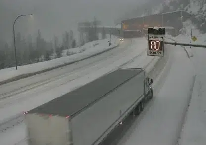
The Great Bear Snowshed on the Coquihalla highway between Merritt and Hope on Dec. 21, 2020. (Photo via DriveBC)
Not a good day to travel in the southern half of B.C. Heavy snow is falling today in Kamloops and the entire southern Interior.
Environment Canada has a winter storm warning in effect for the Coquihalla from Merritt to Hope and for the Okanagan Connector east of Merritt.
A slightly-lesser snowfall warning is in place for Kamloops and the South Thompson region, the Coquihalla north of Merritt, the Trans-Canada Highway from Eagle Pass to Rogers Pass.
Up to 14 centimetres of snow can be expected in Kamloops today, while up to 24 cm is in the forecast from Kamloops to Merritt on the Coquihalla. Up to 35 cm of snow will come down on the Coquihalla south of Merritt, while Rogers Pass east of Revelstoke could see 30 cm.
Forecasters say a low-pressure system is moving north from Washington state, which combined with cold air from the north will lead to heavy snow over most of southern B.C.
For the Coquihalla, the Okanagan Connector and the Allison Pass on Highway 3 – where up to 45 cm of snow could fall today – drivers are asked to consider postponing travelling those routes today. The Fraser Canyon at the Jackass Summit is expected to get 12-14 cm of snow today and tonight.
Heavy snowfall is also expected through the Kootenays, and for some of coastal B.C. including the Fraser Valley and inland Vancouver Island.


